Category Archives: Environment

Talking about the weather, terrain, flora, fauna, etc…

Day 8

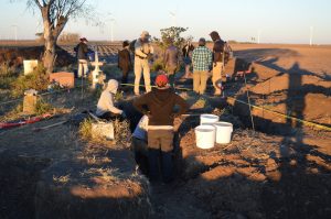
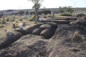
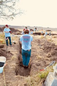
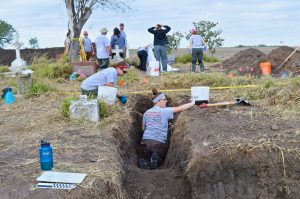
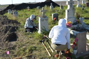
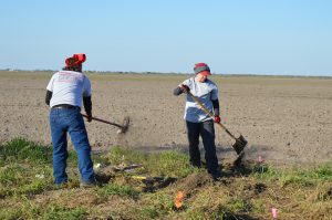
For our second day in Falfurrias, we surveyed cemeteries with Dr. Spradley and Dr. Gocha from Texas State University and Eddie Canalas from the South Texas Human Rights Center. The cemetery survey project was created to locate all the cemeteries in south Texas that have graves with unidentified migrant remains. Cemeteries in several counties have already been surveyed and mapped and more will be added to this list. The goal is to eventually excavate the remains in these cemeteries, so that they can be analyzed, identified, and then returned to their loved ones.

Today we assisted in surveying a total of 3 different cemeteries. Dr. Spradley used GPS to create maps of each cemetery and plot each unknown grave. This was also our first full day actually working outside. It was a beautiful sunny day, but it was also really hot and humid. We were sweating after the first few minutes of being outside, but we survived a whole day of this so we should be okay for helping with the water stations tomorrow.

As we were surveying, I noticed how beautiful the Texas wildlife was. There were lots of colorful birds and flowers. In some areas, it felt like we were in a jungle and not in Texas at all. Palm trees weaved with tall branching trees and created canopies for us to drive under. We looked out the windows of our truck in wonder. I captured some of this beauty on a short video for you all to enjoy!

Driving in Texas

Thanks for reading and watching! Tomorrow should be another busy, but exciting day.

Amanda

Patrolling the Border

Pictured above is the Falfurrias Border Patrol Checkpoint.  The highway it blockades, US 281, spans from Mexico to the Canada border.  It is one of the many ways the U.S. Border Patrol polices our borders.

Falfurrias checkpoint sign stating year-to-date seizures of 15,593 drug seizures and 10,162 migrant seizuresI learned a lot about the different methods agents use on this trip.  Please allow me to give you a brief tour of a few of them.

The border wall with a hazard sign outfront stating "Watch for oncoming traffic"Perhaps the most obvious is the fence at the border.  It lies on the U.S. side of the Rio Grande.  It is a stretch of steel and steep cliffs.  It is also lined with many remote sensing devices.  We were in this location for only a matter of moments before Border Patrol arrived to greet us.

Upclose image of the metal panels of the border wallThe fence does not span, the entire length of the border, but where it does it is quite intimidating.  There are stories about migrants trying to sneak past, only to be killed by the slow crushing force of the mechanical gates.

Warning signs in English and Spanish stating "Warning Gate can cause serious injury or death"Another new addition to the arsenal of the Border Patrol is the aerostat.  The aerostat is a tethered dirigible that is outfitted with cutting edge technology.

An aerostate surveying in the Texas sky over the brushThat tiny blimp in the background is the aerostat.  Each one costs roughly $2.5 millions dollars.  It has the capabilities of surveying over 20 miles.  It is also equipped with thermal and night-vision.  It can remotely survey vast areas of desert that would otherwise be nearly impossible.

A zoomed-in image of the aerostat in the Texas skyEven with my largest zoom lens,  the aerostat is barely visible in the distance.

High-wire power lines extending as far as the eye can see in a small opening in the brushThe tract of land above is colloquially known as “The High-Wire”.  The high-wire is a swath of power lines that runs due north, making it a perfect landmark for migrants to follow (especially in an otherwise landmark-less terrain).  It is also peppered with remote sensing devices.  This makes it a powerful tracking device for Border Patrol, and a dangerous pathway for any migrants.

A paved road bordered by a dirt maintenance roadIn addition to all of the high-tech patrolling methods, border patrol also uses several low-tech methods.  Most of the ranches in South Texas are surrounded by dirt maintenance roads.  The maintenance roads on the inside of the fence are mainly used by the ranchers.  The maintenance roads on the outside of the fence are heavily utilized by the Border Patrol.

Three discarded tires viewed through trees on the dirt roadTires like these are dragged with chains behind vehicle to grate the road.  After the road is grated, Border Patrol can track footprints across the dirt pathways.

These are just a few of the many tools that the U.S. Border Patrol uses to detect individuals crossing the border.

Justin

Water Stations

UIndy student writing data on a paper next to a water station
Collecting water station data

One of the main tasks that we’ve been asked to help with while we’re volunteering at the South Texas Human Rights Center is filling the water stations. We talked about the water stations a little bit in a previous post, but I think they warrant more attention. A water station is a plastic barrel filled with jugs of water. These stations are placed in areas where undocumented border crossers (UBCs) are most likely to be traveling through. A long pole with a flag on the top is attached to the barrel in hopes that UBCs who are struggling through the desert will see the flag in the distance and head towards the station. These stations were started with the intention of preventing more UBC deaths, since many UBCs succumb to death by exposure to the elements.

Map of Brooks County with the water stations marked with pins with an individual pointing at the map
Water station map

Hanging on the wall of the South Texas Human Rights Center is a map of Falfurrias with pins marking the location of every water station they have set up on it. The amount of pins on the map is impressive and the Center has plans to add more stations in the future. Many of these stations are located on private ranch lands. A number of landowners have agreed to have these water stations on their land and some have even asked if the Center would place stations on their land. We’ve learned over the last couple of days that managing all of these stations is no easy task. The stations are placed along several different routes. Each route takes about two hours to complete and there are five routes in total.

The Center checks on each station at least once a week to refill the barrels with water and also to collect data on the usage of each station. Some stations are heavily used while others are hardly used at all. Collecting this data helps the Center figure out which routes need more water stations. For each water station, we tallied up how many jugs of water were left, got rid of any damaged or empty jugs, and then added more jugs if needed. There are only two people at the Center in charge of managing all of these stations and I have a lot of admiration for the both of them. I’ve been on two routes so far and I can tell you that it is exhausting work.

A dirt road surrounded by greenery with blue skies
Traveling down a route

Helping fill waters stations has given me some insight into the UBC’s journey. I can’t begin to imagine what it’s like for UBCs trying to get through the dense brush of these ranch lands. I was tired and hot after doing only one route and we drove in a car for most of the time and stopped periodically to check on water stations. As I drove through the ranch lands, I noticed the wilderness and the remoteness of the areas we were traveling in. There are no markers to tell you which way you are going. No mountains in the distance, no major changes in vegetation. All the land kind of looks the same and I can see how easy it would be for someone to get lost and walk around in circles for hours.

I’m happy that some of the water stations are being used. The thing that really gets me is that just by doing something as simple as putting a jug of water in a barrel, I may have helped save a life. I only wish I had more time to help out at the Center.

Amanda