Image Archives

Day 7: Smarter AND Harder

I’ve been fortunate to be part of Team UIndy for part of yesterday and for the full day today. I was part of the team for all of the first two digging seasons, but unfortunately wasn’t able to help for the full season this year. But because I was able to be with the team for the full day today, I figured I’d write today’s post.

Today the team started the main process of working on the first section we ever worked on here in Sacred Heart Burial Park, from 2013. This is an incredibly challenging task, because it involves moving more dirt than we’ve ever moved before, in a very small window of time. Essentially, we were tasked with developing a strategy that allowed a six-person team to completely check a plot of land that was originally searched by approximately 30 people back in 2013. We only had one gravemarker to show us where a grave could be, and we knew that we would encounter empty coffins from 2013 after we had already exhumed the individuals from inside, which could eat up our limited amount of time.

Our solution: we dug three trenches, each about a meter apart and about half a meter deep, that spanned a main portion of the plot of land and from which we will expand in the coming days. From the trenches, we could probe deeper with a T-probe to try and find coffins, and we could also probe at an angle into adjacent areas without having to dig. With this strategy, we can check all of the land with only doing about a third of the digging. And it worked.

Today we recovered two individuals, one that was marked by the aforementioned gravemarker, and the other being someone that was missed in the 2013 exhumations. We also found a few empty coffins, but were able to analyze the situation, verify that there were no individuals inside, and continue along efficiently. I made the cliche remark to Justin today, “Work smarter, not harder”, and he replied, “I hate that phrase. Every time I hear it I think ‘How about you just do both?’ “. Today was that day: we worked smart, and hard.
Ryan

Water Stations

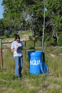
UIndy student writing data on a paper next to a water station
Collecting water station data

One of the main tasks that we’ve been asked to help with while we’re volunteering at the South Texas Human Rights Center is filling the water stations. We talked about the water stations a little bit in a previous post, but I think they warrant more attention. A water station is a plastic barrel filled with jugs of water. These stations are placed in areas where undocumented border crossers (UBCs) are most likely to be traveling through. A long pole with a flag on the top is attached to the barrel in hopes that UBCs who are struggling through the desert will see the flag in the distance and head towards the station. These stations were started with the intention of preventing more UBC deaths, since many UBCs succumb to death by exposure to the elements.

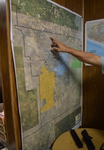
Map of Brooks County with the water stations marked with pins with an individual pointing at the map
Water station map

Hanging on the wall of the South Texas Human Rights Center is a map of Falfurrias with pins marking the location of every water station they have set up on it. The amount of pins on the map is impressive and the Center has plans to add more stations in the future. Many of these stations are located on private ranch lands. A number of landowners have agreed to have these water stations on their land and some have even asked if the Center would place stations on their land. We’ve learned over the last couple of days that managing all of these stations is no easy task. The stations are placed along several different routes. Each route takes about two hours to complete and there are five routes in total.

The Center checks on each station at least once a week to refill the barrels with water and also to collect data on the usage of each station. Some stations are heavily used while others are hardly used at all. Collecting this data helps the Center figure out which routes need more water stations. For each water station, we tallied up how many jugs of water were left, got rid of any damaged or empty jugs, and then added more jugs if needed. There are only two people at the Center in charge of managing all of these stations and I have a lot of admiration for the both of them. I’ve been on two routes so far and I can tell you that it is exhausting work.

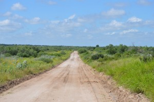
A dirt road surrounded by greenery with blue skies
Traveling down a route

Helping fill waters stations has given me some insight into the UBC’s journey. I can’t begin to imagine what it’s like for UBCs trying to get through the dense brush of these ranch lands. I was tired and hot after doing only one route and we drove in a car for most of the time and stopped periodically to check on water stations. As I drove through the ranch lands, I noticed the wilderness and the remoteness of the areas we were traveling in. There are no markers to tell you which way you are going. No mountains in the distance, no major changes in vegetation. All the land kind of looks the same and I can see how easy it would be for someone to get lost and walk around in circles for hours.

I’m happy that some of the water stations are being used. The thing that really gets me is that just by doing something as simple as putting a jug of water in a barrel, I may have helped save a life. I only wish I had more time to help out at the Center.

Amanda